
Red Trail – Adrian’s Way (Loop) Walking Trail
Starting Point: Picnic Area (Mohercrum). RED Waymark Signs.
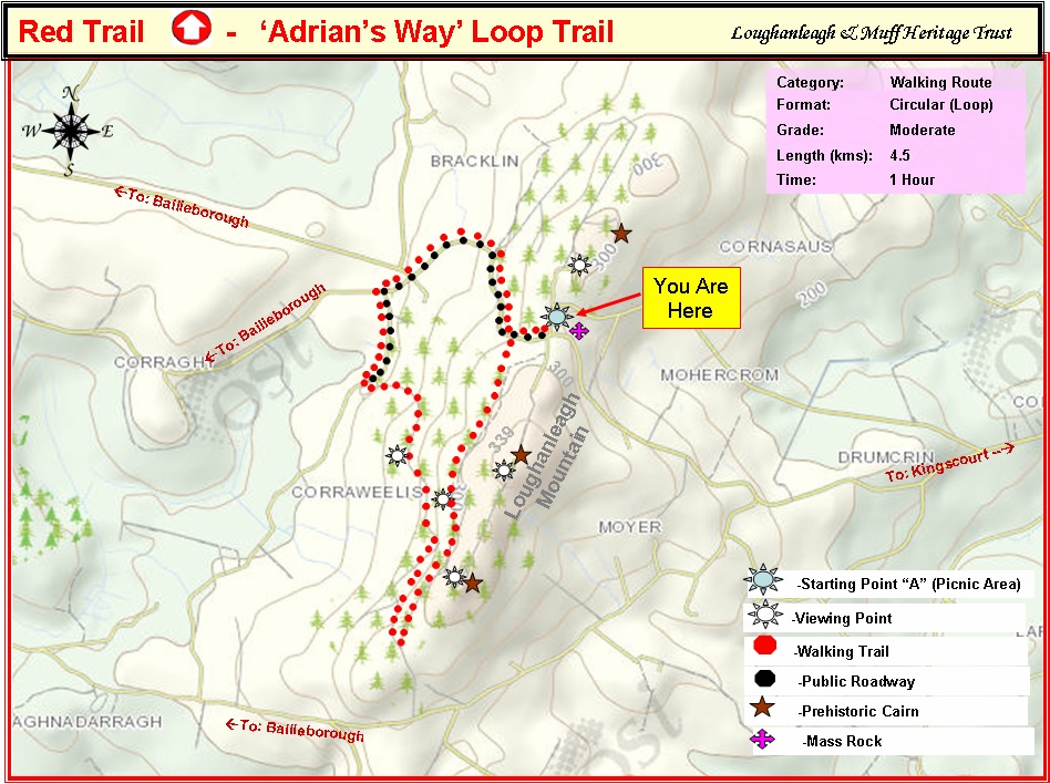
To enlarge map click on image
There is a fairy fort to the right of the mass rock with lovely views at the picnic area .
To access the walking trail, follow the Red Waymark and ‘Adrian’s Way’ sign 100 metres west (Towards Bailieborough) from the Mass Rock on the main road. Turn left at the trail sign and go through the kissing gate to access the walk through the Coillte forest.
After 600 metres there is a bench on the right with views towards Bailieborough and Cavan Town. On a clear day Cuilcagh Mountain and the windmills in West Cavan are visible. With a height of 665 metres, Cuilcagh is the highest point in both counties of Cavan and Fermanagh and the 165th highest on the island of Ireland. If you proceed a further 600 metres approx. the path enters a forested area. Upon reaching a fork in the path, if you turn left at the viewing point sign this will lead you to a section of ridge offering panoramic views of 13 counties and to the East is the Irish Sea. At this point, if you take the narrow path to your right it will provide access to one of Loughanleagh’s three stone age Cairns.
After rejoining the main path through the forest, continue on the trail until you reach a “T” junction. Take the path to your right and continue on this trail until it takes you out to the public road. This trial offers panoramic views towards Bailieborough and west Cavan The decent on this path is stoney in places with loose gravel, so sensible footwear is advisable. On arriving at the forestry barrier, proceed onto the road and turn right until you arrive at a “T” junction meeting the public road. Turn right at the “T” junction and continue on the public road which involves a steep ascent to return you to your starting point at the picnic area. This trail has been developed with the kind permission and co-operation of Coillte.
The map outlines the walkway for you.
Facilities: Picnic Tables; Information panels
Terrain: Mountain & Forest paths and Public Road
Distance: 4.5km
Grade: Moderate
Approx Time: 1.45 hr