
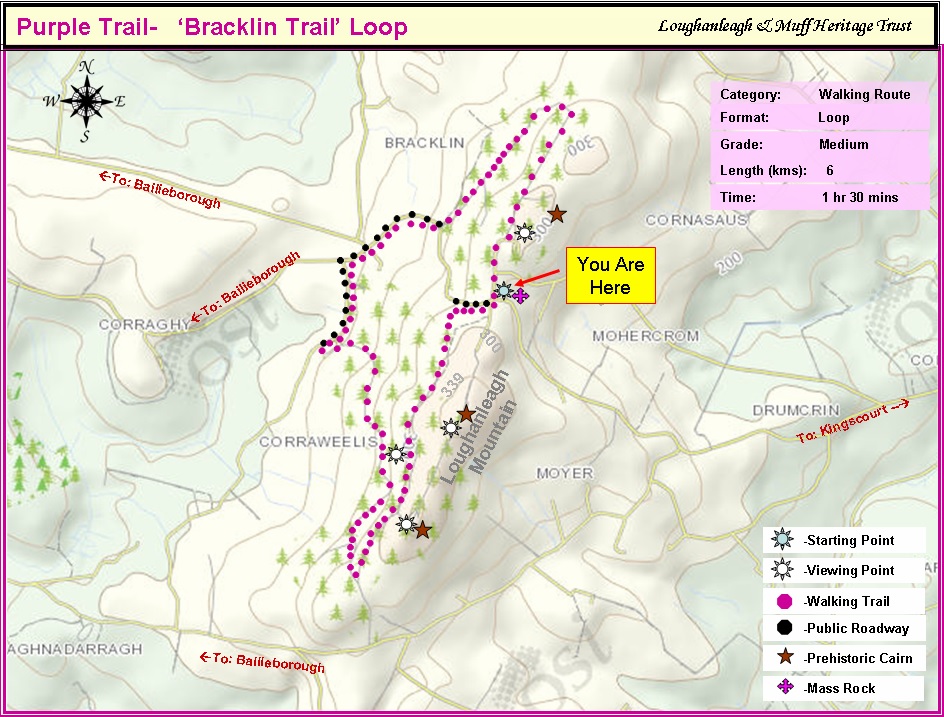
Purple Trail – Bracklin Loop Trail
Starting Point: Picnic Area (Mohercrum). Purple Waymark Signs.
Click on image to enlarge
There is a fairy fort to the right of the mass rock with lovely views at the picnic area .
To access this walking trail, turn right and follow the Purple Waymark signs at the picnic area. After 120 metres continue straight through to enter the Greenbelt Forest entrance at the steel barrier. Continue for 150 meters approx. and keep on the main trail path to your left and follow the purple waymark signs until you reach the main road on the west side of Loughanleagh mountain. This trail offers beautiful panoramic views on its western flank towards Bailieborough and West Cavan. The Cornasaus Cairn (one of the 3 prehistoric cairns across Loughanleagh’s summit) is situated on the eastern perimeter of this forest belt. Presently, this is not easily accessible but we are hoping to develop an access point to this cairn in the near future.
After rejoining the main road, turn right (follow the purple waymark signs) and continue for 55o metres until you reach a road to your left. Proceed down this road for 400 metres approx until you arrive at the Coillte forest entrance on your left and proceed through this entrance and follow the purple waymark signs which will co-join with the Adrian’s Way trail and loop you back to your starting point at the picnic area. This trail has been developed with the kind permission and co-operation of Coillte Ltd.
The map outlines the walkway for you.
Facilities: Picnic Tables; Information panels
Terrain: Mountain & Forest paths and Public Road
Distance: 6 km
Grade: Moderate
Approx Time: 1hr 30 Mins approx.